Excavating in downtown Norfolk presents a completely different challenge than cutting into the ground in the Ghent district, even though they sit just a couple of miles apart. Downtown, you are often working right against the Elizabeth River, where the water table can be less than 4 feet below the surface. In Ghent, the dense urban fabric of historic buildings means vibration and settlement monitoring becomes the primary concern. The common thread across all Norfolk neighborhoods is the underlying geology of the Atlantic Coastal Plain, a mix of soft clays, loose sands, and layered marine silts that demand constant vigilance. A test pits investigation often reveals these rapid soil transitions before shoring even begins. Integrating real-time monitoring with a solid pre-construction understanding is how we keep Norfolk’s projects on track, avoiding the costly delays that groundwater intrusion can cause.
In Norfolk's coastal plain geology, the margin between safe excavation and a costly setback is often measured in hundredths of an inch.
How we work
Local ground factors
The tidal influence of Hampton Roads creates a unique risk profile that static soil mechanics alone cannot predict. A falling tide can reduce lateral support against sheet piles within minutes, while a rising tide pushes saltwater into excavations, accelerating the corrosion of tiebacks and potentially destabilizing the base. This dynamic hydraulic environment means that monitoring frequency must often increase during spring tides or after a Nor’easter pushes extra water into the Chesapeake Bay. Without continuous piezometric data, a contractor might misjudge the effective stress in the soil, leading to a sudden base heave that swallows equipment. The local requirement to protect century-old infrastructure, like the utility lines running beneath Granby Street, makes real-time vibration and settlement data not just a best practice, but an essential insurance policy against third-party claims.
Regulatory framework
ASTM D6230-21 (Standard Practice for Monitoring Earth or Structural Health), IBC 2021 Section 3304 (Excavation Safeguards), OSHA 1926 Subpart P (Excavation Standard)
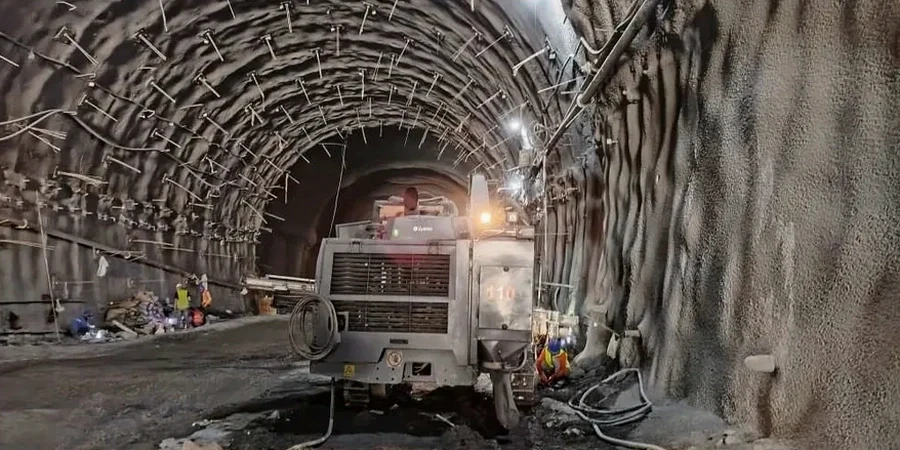
Related services
Inclinometer & Settlement Monitoring
Continuous lateral movement tracking in grooved casings combined with precision optical survey of settlement monuments to protect adjacent structures during bulk excavation.
Piezometer Installation & Groundwater Control
Vibrating wire and standpipe piezometers to map tidal influence on the water table. We correlate pore pressure data with excavation staging to prevent hydraulic uplift and base instability.
Vibration & Crack Gauge Monitoring
Triaxial geophones to measure peak particle velocity (PPV) during demolition or rock breaking, paired with digital crack gauges on historic masonry to document pre-existing conditions and construction impacts.
Typical parameters
Quick answers
What is the typical cost for geotechnical excavation monitoring on a commercial lot in Norfolk?
For a standard commercial excavation in Norfolk, a monitoring program typically ranges from US$780 to US$2,620 per month, depending on the number of instruments, the required reading frequency, and the duration of the project. A basic setup with a few settlement points and a single inclinometer will be on the lower end, while a comprehensive array with automated piezometers and vibration monitors pushes toward the upper range.
How often should readings be taken during excavation in Norfolk's marine clays?
Initial excavation stages in the sensitive Yorktown Formation clays often require daily readings. Once the movement rate stabilizes below the pre-set threshold, the frequency can shift to weekly. However, after significant rain events or during peak tidal cycles in the Elizabeth River, we recommend returning to daily monitoring for at least 48 hours to capture any delayed pore pressure response.
What are the visual signs that a shoring system needs immediate monitoring intervention?
Look for fresh cracks in the pavement parallel to the excavation line, inward rotation of the soldier pile tops, or sand boiling at the base of the cut. In Norfolk’s high water table, a sudden increase in turbidity in sump pump discharge can also signal soil migration and a developing void behind the wall, requiring an immediate survey check and potential load reduction.
Do you provide monitoring for small residential basement excavations in Norfolk?
Yes, we scale our instrumentation for residential projects, particularly in historic districts like Freemason where protecting adjacent 19th-century foundations is critical. A focused monitoring plan using optical prisms and manual crack gauges can provide the necessary documentation and early warning for sites where large automated systems are not practical.