Norfolk’s urban fabric has always been shaped by water, from its colonial-era wharves to the modern redevelopment of the Elizabeth River waterfront. That proximity to the Chesapeake Bay means virtually every excavation and embankment in the city contends with the Atlantic Coastal Plain’s layered stratigraphy: soft Yorktown Formation clays, interbedded sands, and a groundwater table that sits barely a few feet below the surface. When a developer breaks ground at the former Lamberts Point docks or prepares a cut for a new stormwater basin off Granby Street, the question isn’t just about bearing capacity—it’s about whether the slope will stay put through a Nor’easter. A thorough slope stability analysis becomes the financial and legal safeguard for the project, confirming that soil mass movement won’t threaten adjacent properties or delay construction. We combine site-specific data from in-situ permeability testing with limit equilibrium modeling to quantify the factor of safety under both drained and undrained conditions, giving owners a clear picture of the risk before a single cubic yard of earth is moved.
In Norfolk, slope stability isn’t just about soil strength—it’s about how the groundwater regime interacts with a 2-foot tidal swing and a hurricane-season storm surge.
How we work
Local ground factors
The 2011 Mineral, Virginia earthquake, though centered 130 miles away, sent a clear tremor through Norfolk and underscored the region’s seismic vulnerability in a way that surprised many local engineers. While seismic loading is only one input, the combination of loose, saturated sands found in the Poquoson Member and a design earthquake event can trigger a dramatic loss of strength in a slope that appeared stable under static conditions. The risk is compounded by Norfolk’s average elevation of just 15 feet above mean sea level, where a heavy rain event can saturate the upper soil profile in hours. A failure isn’t a gradual inconvenience—it can shear a utility trench, undermine a foundation, or send sediment into an adjacent waterway, triggering costly environmental penalties. The cost of a slope stability analysis is measured against the six- or seven-figure liability of a slide repair.
Explanatory video
Regulatory framework
ASCE 7-22 Minimum Design Loads, IBC 2021 Chapter 18 Soils and Foundations, ASTM D1586 Standard Penetration Test, ASTM D2487 Soil Classification, FHWA NHI-06-088 Soil Slope and Embankment Design
Related services
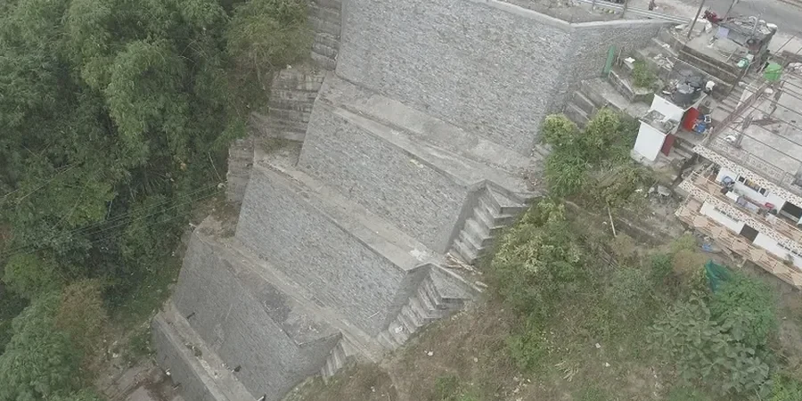
Stability Modeling for Cuts and Embankments
We develop 2D and 3D models calibrated to the marine and fluvial deposits typical of Norfolk, evaluating circular and block-type failure surfaces. The output includes reinforcement specifications, drainage requirements, and phased construction sequencing that respects the city’s tight working corridors.
Forensic Slope Assessment and Repair Design
For slopes that have already moved—whether a surficial slump in a residential subdivision or tension cracks behind a commercial retaining wall—we diagnose the failure mechanism and design a remediation strategy, often pairing buttress drains with targeted soil improvement.
Typical parameters
Quick answers
What triggers a slope stability analysis requirement in Norfolk?
The city’s zoning ordinance and the Virginia Uniform Statewide Building Code (USBC) typically require a stability analysis whenever a cut or fill exceeds 5 feet in height and is located within a horizontal distance equal to twice the slope height from a property line, right-of-way, or structure. The requirement is also triggered by the presence of the Yorktown Formation’s sensitive clays, which are known to lose significant strength when remolded or saturated.
How much does a slope stability analysis cost for a Norfolk site?
For a typical commercial or residential development site in Norfolk, a complete stability analysis—including the necessary subsurface investigation, laboratory testing of shear strength, and the computational modeling—ranges from US$1,310 to US$3,760. The scope depends on the slope height, the complexity of the soil profile, and whether a seismic analysis is required by the structural engineer’s design criteria.
How long does it take to complete a slope stability analysis?
You should budget two to three weeks from the start of field drilling to the delivery of the final report. The subsurface investigation and sampling typically take one to two days on site. The laboratory program—including consolidated-undrained triaxial tests on the marine clays—runs concurrently and requires about seven to ten days for proper saturation and shearing. The modeling and reporting phase fills the final week.
Can a stability analysis help reduce my construction costs?
Yes, and that is often the most overlooked benefit. Instead of conservatively flattening a slope to a 3:1 ratio and consuming valuable square footage on a tight Norfolk lot, a rigorous analysis allows the design team to justify a steeper, reinforced slope or a more efficient retaining structure. The savings in reduced excavation, imported fill, and land area can easily recover the cost of the geotechnical investigation several times over.